Product Overview
FLOOD & WATER DASHBOARD
The Flood Track and Water Track Dashboard is the common lens into the emergency data.
It allows DC Water to monitor and respond to an emergency faster by using data from multiple real-time feeds. This helps to identify the location and severity of a problem and determine which crews to dispatch to which locations.
1. Work order Statistics
2. Various sensor and station data
3. Incident count reported by customers
4. Weather info and rainfall data
5. Crew information
6. Alerts on map by location
- Common lens into emergency data for Flood Track.
- Uses real-time feeds for faster emergency response.
- Helps identify problem location and severity.
- Determines which crews to dispatch.
- Displays work order statistics, sensor/station data, incident count, weather/rainfall info, crew information, and alerts on a map.
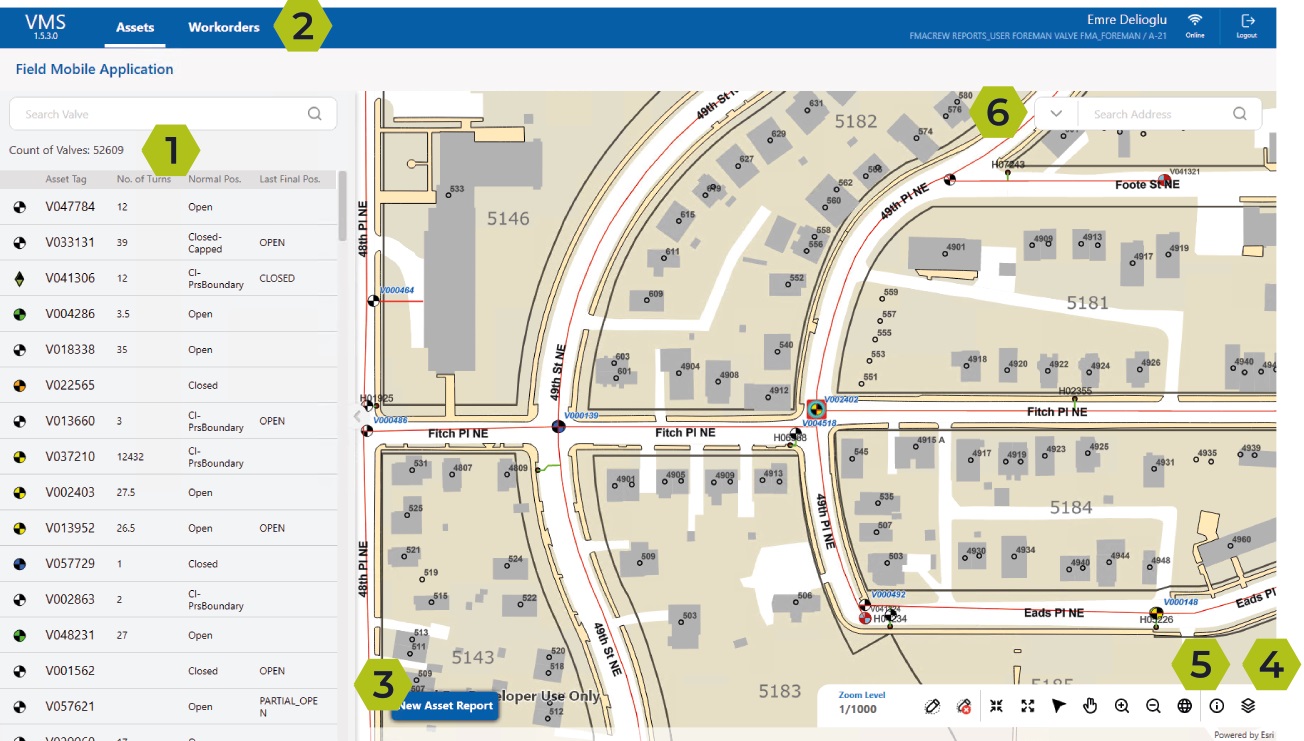
INCIDENT TRACKING
The Incident Tracking Tool enables the Command Center to provide a coordinated, rapid and information-driven process for capturing customer contacts or incidents as they are reported. Incidents are gathered either over the phone, through a real-time, web-based Report-A-Problem application, or through a live feed from the District’s 311 call center.
1. Create and View Incidents
2. Track work orders by status
3. Attach incidents to work orders
4. Geospatial information
5. Keep updated via Live Stream
- Captures customer contacts/incidents from phone, web-based or live feed.
- Provides coordinated and rapid incident tracking process.
- Enables creation and viewing of incidents in real-time.
- Tracks work orders by status.
- Allows attachment of incidents to work orders.
- Offers geospatial information for location-based insights.
- Keeps users updated via Live Stream.
RESOURCE MANAGEMENT
The Resource Management Tool is used to monitor and control the teams & vehicles. Analytical capabilities correlate calls by date, time, location, type, and frequency, thus allowing for more precise allocation of resources while ensuring all stakeholders remain informed as events escalate.
1. Real-time crew and vehicle status
2. Real-time crew and vehicle location
3. Incident type and severity
4. Work order type, location and status
- Monitors and controls teams and vehicles.
- Analyzes calls by date, time, location, type, and frequency.
- Enables more precise allocation of resources.
- Provides real-time crew and vehicle status.
- Provides real-time crew and vehicle location.
- Tracks incident type and severity, work order type and location, and work order status.
ALERT TRACKING
The alert tracking tool is used to monitor and control the incidents. It displays all alert levels in real-time so users can respond alerts faster. In case of any alert sitation, an e-mail & message is automatically sent to the users depending on the alert level.
1. Track real-time incident counts
2. Real-time message/e-mail notification
3. Incident separation by type based on pressure zone/ward
4. Clear incidents
- Monitors and controls incidents.
- Displays all alert levels in real-time.
- Sends automatic e-mail and message notifications to users based on alert level.
- Tracks real-time incident counts and separates incidents by type based on pressure zone or ward.
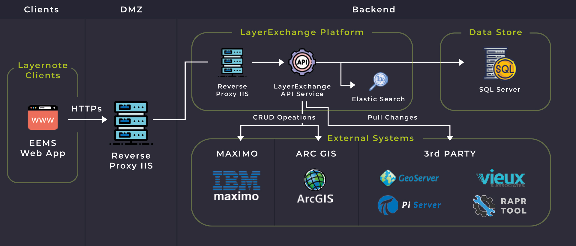
INTEGRATIONS
LAYERMARK’s EMS can be integrated into various work management systems and geospatial solutions such as Maximo, Everbridge, ArcGIS, Geotab, CityWorks and SAP using the LayerExchange platform. Real-time distribution and collection system data is gathered through an OSI Pi Server which consolidates Process Control System (PCS) and SCADA data on a single platform and allows for seamless sharing with EMS. Vehicle location data (GPS) integration enables near real-time monitoring of vehicle status and location.
Discover the Benefits of EMS
LAYERMARK’s EMS is specifically designed for water utilities, offering tailored solutions such as real-time water monitoring and situational awareness to enable quick response and optimized resource management in day-to-day operations as well as emergencies.
Real-time Monitoring and Analytics: Respond faster to emergencies with real-time monitoring and analytics capabilities.
Efficient Resource Allocation: Optimize team and vehicle resources with the Resource Management Tool’s advanced analytical capabilities.
Quick Incident Response: Respond quickly and effectively to incidents with the Incident Tracking Tool, minimizing disruptions to operations.
Minimized Impact of Emergencies: Reduce recovery time and minimize the impact of emergencies with comprehensive situational awareness.
Streamlined Operations and Improved Responsiveness: Streamline operations and improve responsiveness with EMS tools, increasing efficiency and safety.
Intuitive UI/UX: Enjoy an easy-to-use interface with user-friendly features, reducing training time and increasing efficiency.
Integratable with Leading Solutions: EMS integrates with work management systems and geospatial solutions like Maximo, Everbridge, ArcGIS, Geotab, CityWorks, and SAP. Maximize the power of your existing systems and achieve greater insights and efficiencies.
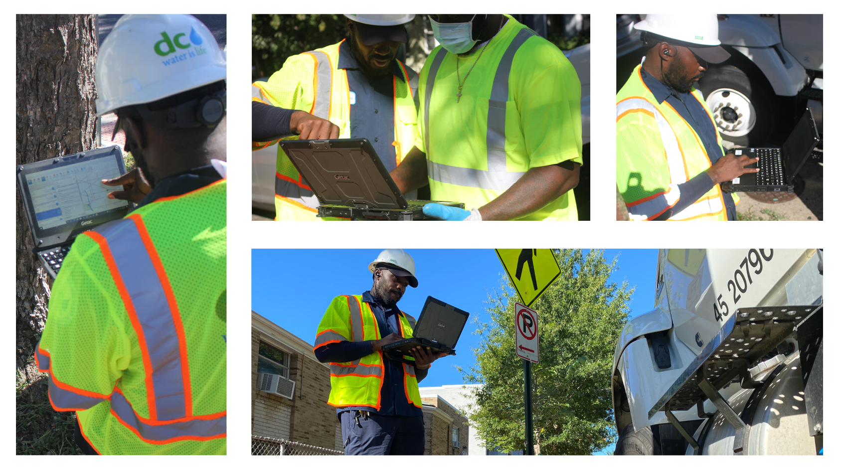
EVENT MANAGEMENT SYSTEM IN ACTION
Our Vision
“LAYERMARK envisions a world where emergency response efforts are efficient, coordinated, and effective. With its powerful Event Management System, LAYERMARK aims to equip organizations with the tools they need to navigate through emergencies, minimize damages, and ensure safety.”